

Make the most of a frosty, sunny weekend in Birmingham before wind and rain arrive next week
The Met Office expects a dry, bright, frosty start to the weekend across the Midlands, then Atlantic low pressure bringing milder, wetter, windier weather from Monday.
Birmingham's cold, frosty spell is set to give way to milder but much wetter and windier weather next week, as a powerful Atlantic jet stream builds a large area of low pressure over the UK, according to the Met Office's latest 10-day trend.
That makes this weekend, and Saturday in particular, the best chance for a while to get outdoors in dry, bright conditions.
A sunny, frosty Saturday
The forecasters said this week's cold northerly air would bring "one of the most widespread frosts of the autumn so far", with sheltered rural spots dropping to between -5C and -7C and some towns and cities approaching or dipping below freezing.
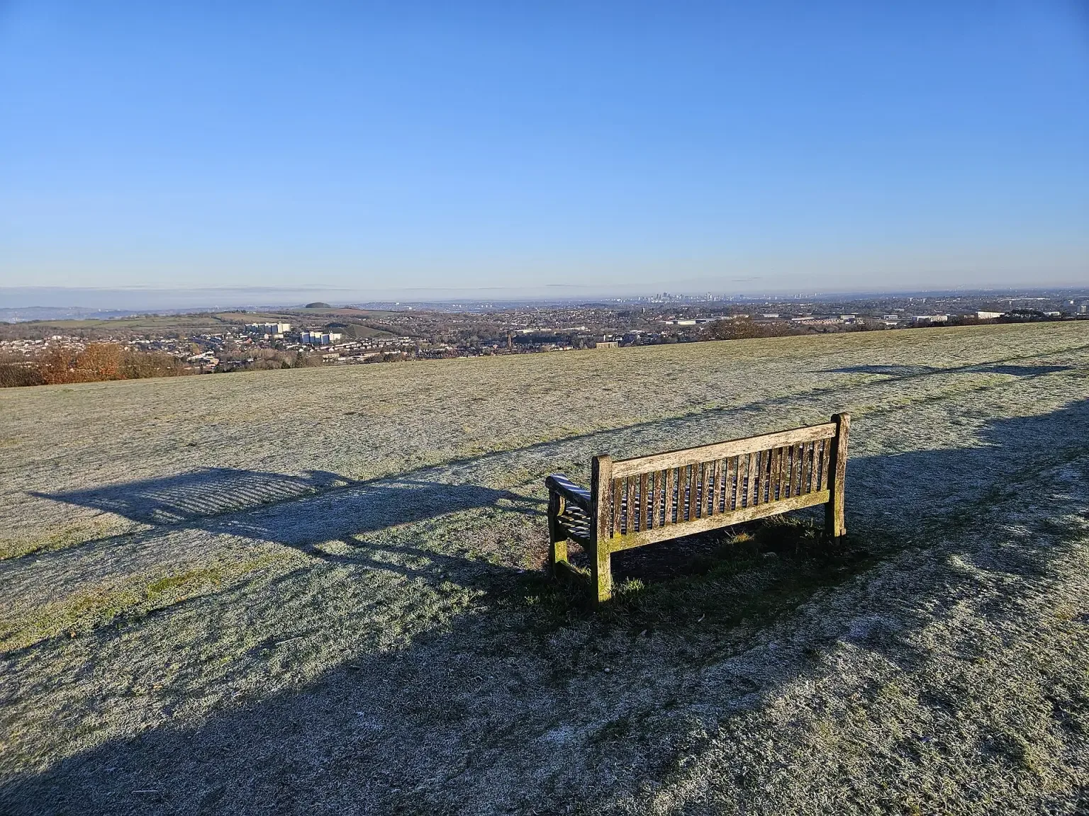
For Saturday, the Met Office says "much of the Midlands, eastern and south-eastern England should start Saturday dry, sunny and frosty." Rain will spread across northern and central Scotland, with showers for northern England and north Wales, but Birmingham looks set to stay on the bright side, with daytime temperatures in the single figures.
The views from high ground such as Beacon Hill in the Lickey Hills, where Birmingham's skyline can be picked out on a clear morning, should be at their best before the cloud arrives.
Sunday: dry but cloudier
Sunday will be mixed across the UK. Snow is expected over the hills of northern Scotland, where 5 to 10cm could settle on the tops, but the Met Office says "England and Wales should remain largely dry, although increasingly cloudy." Cloud and patchy rain or showers will spread into western areas and Northern Ireland.
Atlantic weather from Monday
From later on Monday and through much of next week, low pressure is expected to dominate. The forecast models still differ on its exact position and depth, but the Met Office says there is "broad agreement on the overall theme: spells of rain arriving from the west accompanied by strengthening winds".
Western hills are likely to see the most rain, and rainfall could be above average across western and southern parts of the UK. Repeated spells of rain could cause some impacts if a lot falls in a short time, and winds could become strong enough to cause problems, although forecasters say confidence in the details will improve closer to the time.
Goodbye to the frost, for now
The upside is that the Atlantic air should bring rising temperatures and fewer frosty nights for most of the UK, although northern Scotland could stay cold enough for more snow on higher ground.
"After a taste of wintry weather and some notably cold nights, the overall direction of travel through the next 10 days is towards a more familiar late-autumn combination of wind, rain and milder Atlantic air," the Met Office said.
Practical tips for the week ahead: clear leaves from gutters and drains this weekend while it is dry, secure loose items in gardens before the wind picks up, and keep an eye on the forecast and any warnings before setting off on longer journeys midweek.
More in Weather
All


Latest news
-
16 Nov
New direct Birmingham to Crewe trains start on 13 December, the first step to a Manchester Airport link
-
16 Nov
Apple launches study of 200,000 people to test how useful AI answers to health questions really are
-
16 Nov
Asian Business Chamber's Diwali celebration at St Andrew's explores innovation, from cybersecurity to football
Featured posts
-
Things to do
Top 10 places to visit in Birmingham
-
Food and drink
The 12 most popular food spots in Birmingham
-
Things to do
The best laser tag locations in Birmingham